
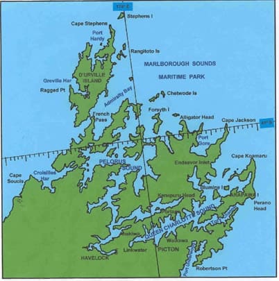
Map of the Sounds
The Marlborough Sounds are a network of drowned river valleys at the top of the South Island. The Guardians' charter covers all the Sounds within the Marlborough District.
Zoning and marine farms
The council's interactive map shows the Marlborough Environment Plan zones, overlays and marine farm areas for any bay.
Environment Plan zoning map (external site)
We do not embed a third-party map here, so this page sets no cookies.
The main waterways
- Queen Charlotte Sound / Tōtaranui
- The ferry route from Picton to Cook Strait, and where the Guardians began. Ferry wash, moorings, salmon farms and water quality.
- Tory Channel / Kura Te Au
- The narrow ferry entrance from Cook Strait. We want ferries and large ships moved to the northern entrance.
- Kenepuru Sound
- A sheltered, shallow arm of Pelorus Sound. Sediment and mussel farms.
- Pelorus Sound / Te Hoiere
- The largest sound, with most of the marine farms, including salmon farms at Waitata Reach.
- Port Underwood
- Forestry, and the log-truck routes we helped replace with barging.
- d'Urville Island and the outer Sounds
- Open water and French Pass. Open-ocean salmon farming is proposed off Cape Lambert.